| 0 komentar |
SCROLL DOWN TO SKIP ADS AND PROCEED TO POSTS


NOT E: SOME OF THESE LABOR DAY SPECIALS ARE AVAILABLE THROUGH SEPTEMBER 21ST SO WE ARE LEAVING THE ADS UP A WHILE.

                   
Shop Amazon - Celebrate Labor Day


Shop Amazon - Off to College - Dorm and Apartment Essentials


Shop Amazon Fashion: Labor Day Savings - 50�70% Off


Shop Amazon - Men's Grooming Best-Sellers


Shop Amazon Fashion: Backpack Shop


Shop Amazon - Save Up to 40% Off Select Strathwood Patio Furniture


                                  . 
    Shop Amazon - Find the Value of Your Gadgets                              Amazon - Shop. Connect. Enjoy. All from Earth's Biggest Selection.
                                                    U.S.Merchant Marine Shop
Shop Amazon Gift Cards. Any Occasion. No Expiration 


THE COAST GUARD SHOP, CG LOGO ITEMS AND BOOKS ABOUT THE U.S. COAST GUARD

                                 DIVER'S BOOK SHELF
   Shop Amazon - Get the New Kindle Fire HDX Tablet                                   
                                                                                                    THE DIVE SHOP


Product Details

STAND UP PADDLE BOARD SHOP

Paddle Board Gear


Product DetailsProduct Details

                                                                   Beach Gear


Read More..

CANADIAN COAST GUARD AT THE NORTH POLE

| 0 komentar |
Two Canadian Coast Guard Icebreakers Reach North Pole
Canadian Coast Guard Ice Breaker Louis St. Laurent (PD)

"Twenty years after Canadian icebreakers first reached the North Pole, two Canadian Coast Guard ships have recreated the feat. The CCGS Louis S. St-Laurent and the CCGS Terry Fox arrived at the North Pole at 7:26 p.m. Wednesday night."  MSN News Canada has the story:

Read More..

MERCHANT MARINE INTERESTS / MARITIME LAW :

| 0 komentar |

British Cruise Line: Passenger Killed After 'Freak Wave' Hits Ship

By Talia Kayali and Chelsea J. Carter, CNN

The British Owned MARCO POLO (Photo:Luca Riva,  GNU Free Documentation License.


"(CNN) -- A passenger aboard the British-based cruise ship MS Marco Polo was killed after the ship was hit by a "freak wave during adverse sea conditions" as it made its way into the English Channel, according to a statement released Friday by the ship's owner, Cruise & Maritime Voyages." Complete Story

OPPORTUNITY FOR A CASE STUDY


NOW IMAGINE THAT YOU ARE THE PERSONAL INJURY FOR THE DECEASED FAMILY OR THE INSURANCE DEFENSE LAWYER FOR THE SHIP OPERATING COMPANY. HOW DO YOU ANALYZE THE ACTUAL CIRCUMSTANCES RELATIVE TO THE "FREAK WAVE CLAIM".WAS IT REALLY A FREAK WAVE, OR NEGLIGENT SHIP HANDLING AND NAVIGATION. TO COMPREHEND THE HEART OF THAT ISSUE YOU MUST BE ABLE TO DEFINE A TRULY "FREAK WAVE" AND MEASURE WHAT ACTUALLY HAPPENED AGAINST THAT. THIS IS WHERE THE AMERICAN ADMIRALTY BUREAU'S COMMENTATORS WHICH WE ARE PUBLISHING FOR FREE USE IN OUR AUTHORITATIVE LITERATURE SECTION. BELOW WE REPRINT THE APPROPRIATE "COMMENT" FROM VOL.3. THERE ARE LESSONS HERE NOT ONLY FOR LAWYERS BUT ALSO FOR MASTERS , MATES, AND PILOTS.

CITE AS: AAB COM. NO.1, VOL. 3 (1966/UPDATED 2013) ISBN 1-87977859-9


FREAK WAVE THEORY

 A "Freak Wave"may be defined as a wave out of proportion to the observable sea state of such magnitude that an ordinarily trained and prudent mariner would not anticipate its presence in the sea state. The "freak wave " is often invoked in personal injury cases involving fast moving boats in a relatively heavy sea state,as a defense against charges of excessive speed. In actuality most such "freak waves" are not freak at all and should have been anticipated. Let's examine an actual alleged `"freak wave" from Admiralty Bureau case records.

Here is a description of the sea state from our record:

 "The weather report by (name withheld to protect client confidentiality) indicated a moderate  Northeast wind flow for the blocks examined all day. North Northeast winds prevailed the day before 10/25/1993. The official observed sea states from Vermilion Block 265 located approximately 5 miles from block 267 indicated seas of 5 to 7 feet at 2258 CST on 10/24/1993 and 5 to 7 feet to 4 to 6 feet throughout 10/25/1993. The boat log indicated seas of 6 to 8 feet. The comparison of the official readings from an adjacent block with the boat log's record indicates a one foot difference in observed sea height. This difference could be accounted by the distance between the recording stations or differences in the height of the eye and experience of the different observers. Winds observed in block 265 varied between 24 to 26.5 knots. It is not known if the boat observer had an anemometer or the ability to correct apparent wind to compute wind speed and direction. Allowing for such differences it appears the closest official weather observations and the logged boat observations are sufficiently close to indicate that the areas had quite similar weather with winds in the 22 to 27 knot range.

Here is our initial analysis:

  The Beaufort scale describes such winds as a "strong breeze" and assigns them the description of "Beaufort no.6". The Beaufort Scale predicts the following descriptive sea state for a no. 6 sea:  ''Large waves begin to form: the white foam crests are more extensive (Probably some spray)".

  The Beaufort Scale indicates that at 22 knots the average wave height will be 6.4 feet while approximately 1/10 of the waves will reach 10 feet and one tenth will be significantly below the average.

  Thus, in a Beaufort Force 6 sea state, a mariner should expect at least more than a 3.6 foot difference between wave heights for at least 10% of the waves encountered. However, at the coincidence of the lowest average wave height and the highest , the difference will be much greater. Finally it should be noted that the Beaufort scale actually utilizes the highest one third of observed waves for average height.The actual variance of wave heights in a given sea state is best illustrated with this quote from "WEATHER FOR THE MARINER" by William J. Kotsch published by the Naval Institute Press.

      "By using table 11-8, it is seen , for example, that if a train has a significant wave height of 10 feet, the highest wave is 18.7 feet, the average highest 10 percent is 12.9 feet, and the mean wave height is 6.4 feet. "

  In the example above, the highest wave in the sea state and some waves of even greater difference are predicted..

  The Beaufort scale is a common feature in much of the authoritative literature utilized by the Coast Guard's National Maritime Center to construct professional mariner license examinations. all licensed professional mariners are , or should be, familiar in literature aimed at amateur boatman, such as Chapman's "PILOTING SEAMANSHIP AND SMALL BOAT HANDLING". 

OUR CONCLUSION:

 A "freak wave" can not include a wave height difference that can be accounted for by the ordinarily jumbled state of any sea as documented in the Beaufort scale.  This wave height difference is often quite steep but should not be a surprise to the properly trained and ordinarily prudent mariner who should expect just such differences and adjust speed accordingly. The mariner should not run at a speed that accounts for only the "typical" or "average" wave height that he is looking at when he sets his speed . He must expect and plan for the ordinary jumbled sea state. Real "freak waves"are the product of more than prevailing wind. They are often the result of geological forces such as earth quakes and submarine volcanic activity. Recent satellite imagery studies have indicated that on any given day there are a few of these truly freak waves moving about the world's oceans mostly off of what we consider the busy shipping routes. While the "freak wave" or "monster wave" may be a daily phenomena on the world's oceans they generally occur thousands if not tens of thousands of miles apart, and are very small in number in the vastness of the world's oceans on any given day. Actual ship or boat encounters with these truly "freak" waves are exceedingly rare. Most litigated cases involving the "freak wave defense" against charges of unsafe speed actually involve wave height differences predicted by the Beaufort scale. The Beaufort Scale is studied by every class of U.S. licensed deck officer and is an expected element in their occupational licensing testing.   Choosing a speed that doesn't consider the wave height differences described in the Beaufort Scale is simply imprudent seamanship.


THE WAVE


Read More..

U.S.Coast Guard Fires Shot In Anger In The Persian Gulf

| 0 komentar |

IT MAY HAVE ACTUALLY BEEN A RETURN SHOT TO AN IRANIAN VESSEL

The U.S. Coast Guard ship Monomoy participates in the International Mine Countermeasures Exercise (IMCMEX) 2013 with Combined Task Force 523. Mass Communication Specialist 2nd Class Terah L. Mollise/Navy

   Photo Credit PO 2 Terah L. Mollise/ U S Navy

 We received word today that a U.S. Coast Guard Cutter fired a single shot at an Iranian Vessel which had aimed a 50 Cal. Weapon at the cutter in the Persian Gulf. Details were sparse, the Iranian vessel may have actually fired a single shot first. Our usual internet search turned up a fairly full story from the highly reliable STARS AND STRIPES. Link below: 

Read More..
| 0 komentar |
NAVAL and MERCHANT MARINE INTEREST:

 THE DEFINITION OF "INNOCENT PASSAGE" IS CHANGING FOR OCEANOGRAPHIC RESEARCH VESSELS:
It's Midnight, Do You Know Where Your Next EEZ Is?


researcher
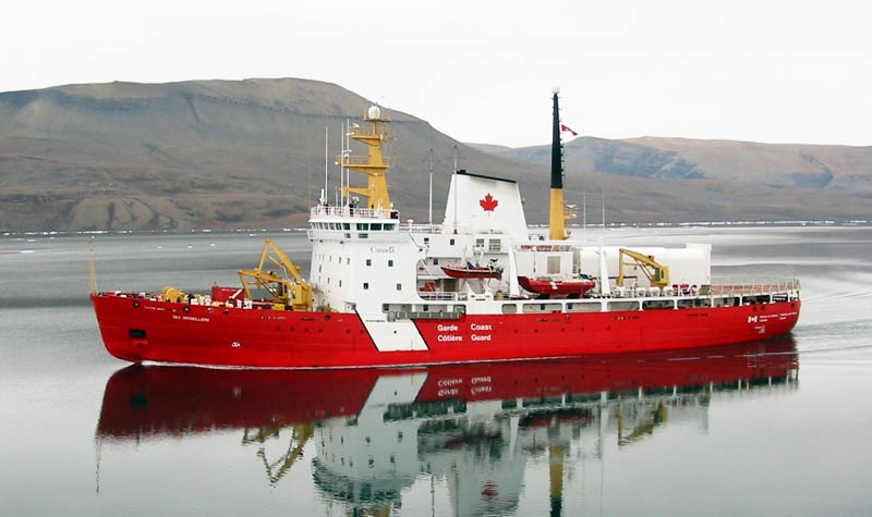
NOAA SHIP RESEARCHER, OFFICIAL NOAA PHOTOGRAPH


  When my life began in 1948, the final year for all steel models, my ship master uncle's main political navigation concern was entry into a foreign nation's "territorial sea". By the time my seagoing career started in the mid 1960s there was already a growing list of considerations for maintaining "innocent passage" in an expanding zone of ocean in which adjacent coastal states claimed special rights. The world had discovered oil on the outer continental shelves (OCS) and had codified special rights over the OCS for adjacent coastal states. The latest expansion on that concept is the Exclusive Economic Zone (EEZ). The international consensus on the EEZ is that it is not dependent on the geophysical definitions associated with the OCS Convention. Some legal authorities had hoped that the EEZ concept would put a 200 mile cap on the outward expansion of adjacent coastal state's exclusive economic rights to bottom resources. But the Russians and the Chinese, just to name two powers, are busy using the EEZ concept in conjunction with the OCS geophysical concepts to claim far more than 200 miles at the expense of neighboring adjacent coastal states. For years, of all of the somewhat qualified rights of innocent passage through these expanding offshore zones of evolving particular adjacent coastal state's rights; oceanographic research was perhaps the least controversial of the internationally recognized rights of "innocent passage". This once happy state of affairs is no longer the case.


 If you are doing voyage planning for an oceanographic research ship today you have to keep in mind that what may well be "academic oceanographic research " to you, may well be considered "economic research" to certain claimants of EEZ rights, real or simply claimed. While probably no one would object to your use of a standard fathometer in an EEZ today a towed seismic array would probably be an open invitation to a boarding by naval, customs, coast guard, or natural resources authorities of the claiming state. If your ship has any other sensors that you normally operate on the high seas or other more specific authorized research areas you may be well advised to turn these off, tag the controls and log the time and position of the ship when the sensors were secured in order to avoid trouble.Unless your mission is to contest someone else's claim you probably don't want to risk trouble in a disputed zone. When in doubt we suggest that you turn off the non navigational electronics.   Here is the problem for practical voyage planning and navigation. How does your bridge team know when they are about to enter an EEZ or contested or claimed EEZ? 

 We searched books in print and several chart and map providers and could find little of use as a practical chart table reference. Moreover the situation with EEZs is in constant flux. So we suggest that the voyage planning team make up their own chart room reference during the voyage planning stage from the latest data. Fortunately, through the astute voyage planning work of a young NOAA Corps Officer we have become aware of an excellent source of electronic information that can serve the purpose of a voyage planning team. Those of you under 30 will immediately recognize this resource and those of you like me who are two days older than water and one day older than dirt will be amazed. Go to "Google Earth 

http://geoboundaries.wordpress.com/2008/07/31/viewing-the-worlds-eez-in-google-earch/

At Google Earth you will find a down loadable graphic and geographic coordinate description of the world's EEZs. The data is easily converted by the cyber skilled into almost any electronic chart or navigational software. The source data is also available in "GIS" shape files for use in professional geo-referencing client software. This is not the only available reference on EEZ locations around the world's oceans but it is the best we have found so far after a wide and fairly skilled search so we thought that we'd share it with fellow navigators and voyage planners and this seemed like a good place to do it. We hope that if any of you have an equal or better resource that you will lets know via a comment as soon as possible. Good luck and unless you intend to challenge some adjacent coastal state's claims, don't cross into an EEZ without securing your non navigational sensors.

Editor's Note: Google's Geoboundaries link is now permanently installed in our OCEANOGRAPHY and NAVIGATION sections along with many other helpful voyage planning tools for the navigator.   

ON LINE MAPS AND CHARTS STORE

No comments:


Post a Comment

Read More..

THE DRONE SHIP WHY and WHY NOT ?

| 0 komentar |

File:Supertanker AbQaiq.jpg
Photo Credit: U.S.Navy

MORE THAN TWENTY FIVE YEARS AGO WHILE ATTENDING MARAD'S LORAN A SCHOOL WE WERE TOLD THAT THE DRONE SHIP WAS TECHNOLOGICALLY POSSIBLE EVEN THEN. BUT WE WERE ALSO TOLD THAT PIRACY / CARGO SECURITY WAS THE MAIN OBSTACLE TO CREW REMOVAL. PIRACY IN SOMALIA HADN'T BROKEN OUT AT THAT TIME. 


 Now referred to as the "autonomous ship" the concept is back in the discussion mode among ship management and insurance groups. The concept is being driven by the evolution of navigation and ship control technology. Today fully manned ships are having more and more functions managed by on board computers. Some on board computer functions can send and receive data from shore based managers and even be programed or operated from ashore. Other labor saving developments such as more durable paint, self service galleys, unmanned engine rooms have so reduced crew size that the operating crew no longer offers much in the way of physical security for large ships. Pirates frequently get aboard unnoticed until it is too late. Ships that once required crews of 35 merchant mariners to operate now routinely operate with crews of 12 with only 4 on watch at any given time.  

PD: Bridge of the OLYMPIC, SISTER SHIP OF TITANIC Fully manual analogue navigation bridge

Reports of various conferences on the subject in various maritime trade journals that we monitor paint a picture of a seemingly inevitable evolution towards the unmanned "autonomous" ship. The evolution begins with a change in the nature of mariner duties from operating to monitoring/operating manual back ups in an emergency. Given present international standards of watch keeping we don't see a reduction beyond a 4 man 3 watch system before the end of this century despite assurances that the necessary technology for the "autonomous" or "drone" large commercial cargo carrier is already available. The apparent consensus of opinion on the continuing evolution towards the "autonomous unmanned ship appears to go something like this:


Photo: U.S. Navy : The mixed digital/ analog/automated/manual bridge

  In the short term, autonomous ships won�t necessarily be unmanned. As more sensors are added to ships, then algorithms will be introduced to learn from that data and make decisions. Actuators will then be linked to those sensors, creating autonomous ships.

In the same way that almost all the technology needed for a self-driving car is already in high-end cars today, commercial vessels will have the capability for autonomy well before they become unmanned. So the evolution will naturally be automation-autonomous-unmanned,�  Roger Adamson, CEO of Futurenautics speaking at Posidonia exhibition


 We don't disagree with the basic concept of the evolution of the unmanned commercial ship, but we don't think unmanned will happen in this century despite the ready availability of the technology. The reasons we don't see it happening are in the realm of political, and here we don't just mean organized maritime labor objections, but a whole variety of political issues from environmental protection to soverignity protection. Additionally insurance consideration, and other loss control considerations will keep the ships manned at least well into the 22nd century. 

 A top priority of commercial shipping hasn't been the rapid development of oil spill mitigation technology. Generally its is still pretty manpower intensive and that includes the "first aid" type measures that ship's crews are expected to take. While professional maritime environmental mitigation companies may have an interest in lowering their paid manpower requirements ships owners have little incentive to automate detection and mitigation equipment for on board use. Environmental regulators are unlikely to smile upon simply abandoning the idea of crew administered first response. We are into the second decade of the 21st century and piracy and maritime terrorism, as well as other crimes directed at ships are rampant. The present modus operandi for piracy seems to be pretty low tech using smaller, faster, boats they come along side and board using old fashioned grappling hooks. It is highly doubtful that by the end of this century commercial large cargo ships will be able to match "speed boat" speeds and operate economically. If you can't out run the maritime criminals a defenseless unmanned cargo barge is a free gift to the pirates. The idea of operating vessels with some sort of automated system capable of defending against pirates will not be readily accepted by world Coast Guard and naval authorities who will often have to board such vessel in trouble and doubt that the "friend/foe distinguishing device in such a system will be sufficiently discriminatory. While fire detection/suppression systems and dewatering pumps can be automated today. Its going to be a long time before they can innovate like a crew trained in damage control.

 I once served on a fairly well automated vessel that was rammed by a freighter with a steering malfunction in port. The automated dewatering pumps immediately kicked in but the infilling water was coming in faster than the pumps could keep up. The ship was starting to list  and continued progressive flooding could have capsized her. The ship would have sunk at the dock but for the action of the Chief Engineer who bravely entered the worse flooding compartment and stuffed a mattress in the hole.Once the pumps started to get ahead of the flooding sources the crew brought more mattresses and shoring to bear on the problem. Eventually the local fire service showed up but seemed clueless other than to offer us some of their portable pumps. Holes stuffed and properly shored the ship made it to the ship yard under her own power later that afternoon. Somebody's insurance syndicate was saved a constructive total loss. These types of crew intervention damage control save many more ships than the suits who are discussing this technological revolution in shipping with its attendant disemployment of human crews realize. But their insurance companies know. Certainly we anticipate changes in crew roles , functions and training as the evolution towards the automated ship progresses. But we don't see is much progress in reducing crew size past the already inadequate manning levels of today. As usual in maritime history the ship owners are on one side and the seamen are on the other. But this time its not just crews striking the cautionary notes to slow the speed of the extinction of the merchant mariner. Insurance, regulators, the general public and every manner of green activists share the seaman's viewpoint. When will we eliminate piracy and marine terrorism? How will the new technologies achieve present levels of safety in fire detection/suppression, and damage control. How will first response pollution mitigation measures be deployed?  How will cargo theft and pilferage be controlled? How much performance data will insurance syndicates require before allowing unmanned automated ships to be insured at or bellow manned rates? 

 Yeah the technology already exists to send drone cargo ships across the ocean, but keeping them safe is another issue. Moreover determining how safe is safe enough will be a political decision involving far more parties at interest than just the ship owners. Here at AAB we don't see any incentive to close down the maritime academy officer schools or Union rating schools. The fact is, there is now a worldwide shortage of seamen and more automation isn't the cure, its just inevitable; but its main function will be enhancing the performance of the crew..   


Read More..

THE WORLD OCEAN THE ULTIMATE JACUZZI

| 0 komentar |
OCEANOGRAPHY:

 THE WORLD OCEAN THE ULTIMATE JACUZZI
  Follow the Hyperlink in this Posting for an Educational and Relaxing Lesson in the World Ocean Currents System.
File:Ocean currents 1943 (borderless)3.png
Ocean Currents Map Prepared By The U.S. Army 1943 Compare With The Rotating Globe Image  This Article Is Linked To. 

 Every Fall the TV weather guys and girls give us all something of a micro lesson on ocean currents as they speculate over the relative severity of the on coming winter. El Nino, La Nina, the Gulf Stream all have parts to play. This Spring the Earth's heat budget is being discussed again in terms of why winter doesn't seem to want to let go in many parts of the nation and the world . But these most famous ocean currents are but a tiny fraction of the oceans circulatory system, which in turn is part of the earth's heat management system. Understanding the whole system seems like a Herculean task. In fact, to the extent that being able to visualize it is understanding, understanding can be fun and relaxing.


 Some earth scientists at NASA have put together a computerized visualization aid on the planet's global ocean current system. It is even set to relaxing music. So sit back in your favorite barco lounger, hit the hyperlink, kick back and enjoy a God's eye view of the ocean as it circulates. The NASA guys posted this to You Tube and we link you because that's what we do, review and post the information on all things maritime because we like the maritime world and we know how. We'll get back to the news of the issues of the day soon, but this show reminds us why we went into the marine professions in the first place, all lousy working conditions, pay issues, and under and over regulation disputes aside. This view of the World's circulatory system is a permanent feature in our OCEANOGRAPHY page along with some other unique features like a virtual dive experience and a site called "LISTEN TO THE OCEAN. The OCEANOGRAPHY page isn't just for oceanographers.Click below to check it out.


   Shop Amazon - Get Up to 80% Back When You Sell Us Your Books      


Read More..

SEA PLANKTON IN OUTER SPACE, REALLY

| 0 komentar |
DOES ANYONE BESIDES US SEE THE BIOHAZARD HERE?
Our SPACE AS AN OCEAN E-Book morphed into PROTOCOLS once we examined the COLUMBIAN EXCHANGE. We felt certain that our first encounter with life in outer space would be microbial, and in fact we've seen previous evidence that something like this could happen.

RUSSIAN COSMONAUTS FIND SEA PLANKTON LIVING ON THE EXTERNAL SURFACE OF THE INTERNATIONAL SPACE STATION


SPACE AS AN OCEAN


                                Photo U.S. Air Force

Russia's space agency has confirmed that traces of sea plankton and other micro -organisms were found living on the exterior of the International space Station. The microorganisms on the exterior of the International Space Station appears to have been there for quite some time. Not quite as voracious and fecund as barnacles on a ship, but a sort of space barnacle that over time could have similar effects on a Space station to that of barnacles on a ship. Cosmonauts Olek Artemyev and Alexander Skvortsov discovered the evidence of a microorganism colony during a routine space walk inspecting the exterior of the station. According to the Russian news agency ITAR-TASS they collected samples and sent them back on one of the supply/crew change capsules for lab analysis. Lab examination confirmed that the samples were micro organisms and micro organic remnants familiar on earth but ruled out that the sea plankton was on anything launched to the station or parts of the station at launch.

 Dr. Valadimir Solovyev, head of the Russian participation in the ISS mission said that plankton in the stages of development found on the stations exterior surface may be found on the surface of Earth's oceans. Solovyev speculated that there are rare uplifting air currents that may reach the low earth orbit station .Apparently a variety of earth origin microorganisms can survive zero gravity, freezing temperatures, lack of oxygen,and cosmic radiation. Solovyev called the discovery "absolutely unique". We however saw something like this coming and want to strike a cautionary note.


Photo ISS mission crew-Public Domain


 As we were researching the portion of our E book PROTOCOLS we became aware of some scientific writings suggestive of the idea that many micro organisms or proto organisms like viruses can survive exposure to space. Their size and low weight don't require the kind of lift to the edge of space that our technology does. Here is the scary part, if there are other planets producing microorganisms they can escape into space too. Moreover there is evidence to support that any such microorganisms that get caught in the earth's gravitational pull are afforded a rather gentle "float down" reentry.  Many of the seemingly out of nowhere virus that we see once in a while may actually have originated elsewhere and entered our atmosphere from outer space. Clearly the Russian discovery proves the theory is possible, perhaps even probable.

 We think that what happened is the microbes arrived  on these atmospheric upwellings and found a neat colony site in near perennial twilight on the station structure. A space station or a pockmarked meteor would have nooks and crannies where there is shelter from full sunlight preventing the microbe from burning up, but enough daylight long enough to prevent hard freezing. No doubt there are microbes that could survive a very long time in such a semi sheltered location.  If accorded a reentry opportunity to reach an opportune environment such micro organisms may thrive. Orbits of softball sized meteors that get trapped in earth orbit decay just as artificial satellite orbits decay. When they fall to earth most of their mass incinerates creating the "shooting stars" we liked to watch as kids. However, some microorganisms that may have made it to the core might survive if enough mass survives to reach the planet's surface. There is also the possibility of detachment from the falling object before it reaches heat generating velocity.

 OUR POINT IS THAT WE HAVE NOW VERIFIED THAT OUR OWN PLANET OCCASIONALLY SPITS MICROORGANISMS INTO SPACE THAT HAVE SURVIVAL POTENTIAL. IF EARTH CAN DO THAT ANY PLANET WITH AN ATMOSPHERE THAT GENERATES MICROORGANISMS CAN DO IT. Indeed space is looking more and more like an Ocean all the time. But apparently we haven't learned much from the Columbian Exchange. The transfer of the organisms to earth didn't seem to follow much in the way of sanitation / isolation protocols. We didn't know about such things at all during the European Sea Recognizance and lots of plants and animals got spread around and are still being spread and becoming either valued agricultural products , or feral pests. The first exchange in the Columbian Exchange was microbial and it reduced the native population of the Americas by millions in a relatively short time. What our E book asks in comparing the Columbian Exchange with our search for extraterrestrial life is, do we have the sanitation / isolation protocols in place to insure that our first encounter with extraterrestrial life won't repeat the negative effects of the inadvertent and ignorantly conducted still on going Columbian Exchange? Well, we have just discovered for the first time life inhabiting outer space , it may not be extraterrestrial in origin but it was certainly in an extraterrestrial location.  It wasn't found by guys searching for life, or on a mission that included specialists for such activity. Basically our first discovery of life in outer space was by two guys doing maintenance. Apparently they just sent it home in a baggie with a note. WE BETTER DO A LOT BETTER THAN THAT WHEN WE ENCOUNTER REAL ALIEN MICROBES. Please read:

PROTOCOLS, Space As An Ocean:


 ITAR-TASS.-l English version of official Russian news coverage


Shop Amazon - Get the New Kindle Fire HDX Tablet 


 Shop Amazon - Trade In with Three Easy Steps 


Read More..